Overview
Many navigation devices and apps can record where you’ve been. This saves your current position at short intervals, for example, every five seconds. Track points consisting of longitude and latitude ( longitude and latitude ) and a timestamp are saved in a list. If the navigation device has a barometer, like many Garmin devices, the elevation is often also saved. This elevation is important for accurately calculating the distance traveled later. Remember the Pythagorean theorem: a² + b² = c²
If you plot these points on a map and connect them with short lines, you’ll see a relatively accurate representation of the distance traveled. Note that this representation becomes more accurate the shorter the recording interval!
If the recorded track points are far apart on long tracks on winding routes and no altitude information is included, the calculated total distance of the track will be significantly shorter than the actual distance covered.
A recorded track is inherently flawed to a certain extent, which is something to keep in mind.
It can also happen that the devices record a significant distance of several meters, but the time interval between the track points is zero. If one later attempts to calculate a speed, this would result in a division by zero, which is undefined and would lead to an error in the evaluating software.
Route Idiot therefore analyzes all track points during import. If they are invalid, an average speed of 50 km/h is assumed and the timestamps of all track points are recalculated.
UTC
For the GPS system to function at all, all GPS satellites have highly accurate clocks, all of which use Coordinated Universal Time (UTC) as their time standard .
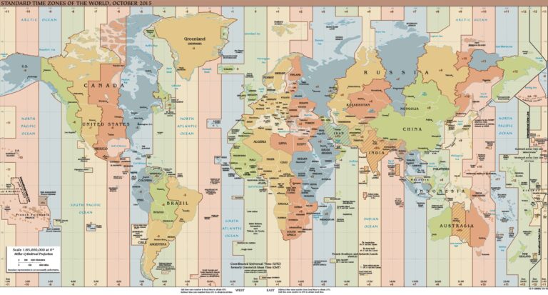
UTC time is used when recording tracks , which is important! There’s also no distinction between winter and summer time. If you record a track in Germany, Spain, or Italy, for example, the timestamps will be one or two hours in the past, depending on the time of year. For example, if you set off at 10:00, the first track point could be 9:00 or 8:00! All of this can be quite confusing.
Route Idiot doesn’t automatically correct track point timestamps during import. The reason is quite simple! If you export and re-import a corrected track, all timestamps would be corrected again, making them completely wrong. If you want, you can correct the timestamps yourself in the track editor. To do so, select the first track point in the track editor, set the desired time in the DateTime picker , and confirm this change. All track points will then receive a new timestamp.
Track vs. Route
Tracks and routes are often confused. Basically, you have a track after a tour and a route before it. While recorded tracks often contain thousands of track points, the simplest route uses just two points: the start and the destination. Everything in between is calculated by the navigation device.
If you were to plan a route from Munich to Nice, for example, different navigation devices would calculate different routes, which is the main problem with route planning . Therefore, tracks are playing an increasingly important role in navigation. If you convert a calculated route into a track in route planning software, devices from TomTom or the new BMW Connected Ride Navigator can navigate with it, which is cool.
In the Garmin world, you can display tracks parallel to calculated routes on devices like the Navigator VI , the zumo XT , or the zumo XT2 . If the track points straight ahead at an intersection, but the calculated route turns right, you can decide for yourself which one you want to trust. If the track is well planned and well researched, you should follow it. The navigation devices will recalculate the current route and usually calculate a route that coincides with the track after a short time.
Tracks don’t contain stops, which is important! They only show the route of a planned or recorded tour. Restaurants or photo stops that you’ve planned during route planning aren’t included in a track! If you want to be sure you don’t accidentally drive past a planned destination, you should split your tracks accordingly. Once you’ve reached a destination, the current track ends, so you can’t possibly miss your intermediate destination. Then you load the next track, which should end at the next stop.
Export tracks
Route Idot offers the option to automatically convert routes into tracks during export and output them alongside the route. There’s also an option to automatically split tracks at via points. See the article on exporting routes for more information.
Importing Garmin devices
Garmin devices like the zumo XT or XT2, or even the BMW Navigator VI, can record all routes as a track by default and display them as a light blue line on the map. This is cool, as it allows you to clearly see where you’ve been a few days ago. A new track is started each time you start the device and automatically ends when the device is turned off. Everything is stored in an archive with numerous GPX files, which are numbered consecutively, such as 1.gpx, 2.gpx, 3.gpx, etc.
It can happen that a file like 27.gpx contains the start of a long stage, but the end is found in file 28.gpx. Extracting a complete, coherent track for a day from this data is therefore a challenge. Route Idiot is based on the Windows Store app Track of the Day . This app does just that: it imports all tracks, analyzes the timestamps of all track points, and creates a „Track of the Day“ from each one . And yes, that’s why this application is called Track of the Day , or TD for short .
TD7 and GSR7
In the first version, TD was just a viewer for tracks, nothing more! But because many users didn’t know the difference between tracks and routes, support for routes gradually found its way into TD. New user requests were continually incorporated, and by version 7.x, TD had become a very powerful planning tool. Some inexperienced users were ultimately overwhelmed by the sheer number of functions and increasingly called for a simpler version.
In the summer of 2025, TD7 was transformed into the new, simpler variant GSR7.
Anyone who feels comfortable and confident with GSR7 can switch to TD7 at any time free of charge and use both systems in parallel.